Chamoli: the catastrophic flood was caused by a landslide
 |
| Google Earth image of the area affected by the catastrophic flood at Chamoli. |
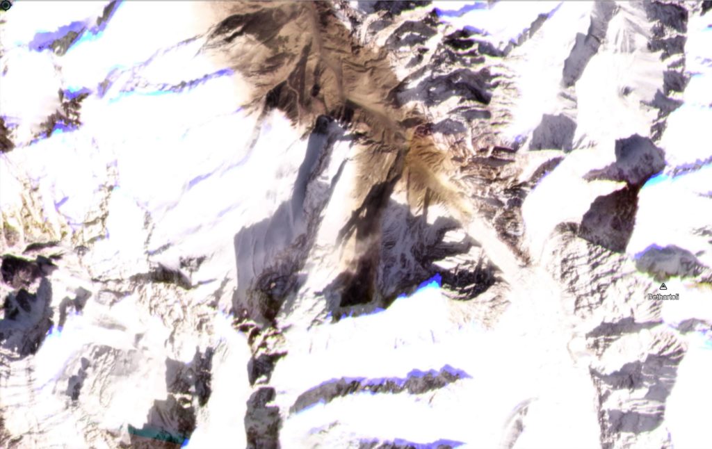
The question as to the cause of this event has been solved by the availability of a Planet Labs image collected today (7 February 2021). Dr Dan Shugar of the University of Calgary was the first person to deduce from this that the cause of the disaster was a landslide. This image shows the source of the disaster – it a large rockslope detachment from Trishuli, The scar is the dark area just below the centre of the image. It has moved northwards onto the glacier, and turned into a rock and ice avalanche that has moved toward the northwest. Note the huge amounts of dust that has been left by the landslide:
 |
| The landslide from Trishuli that caused the Chamoli flood. Image copyright Planet Labs, used with permission. |
 |
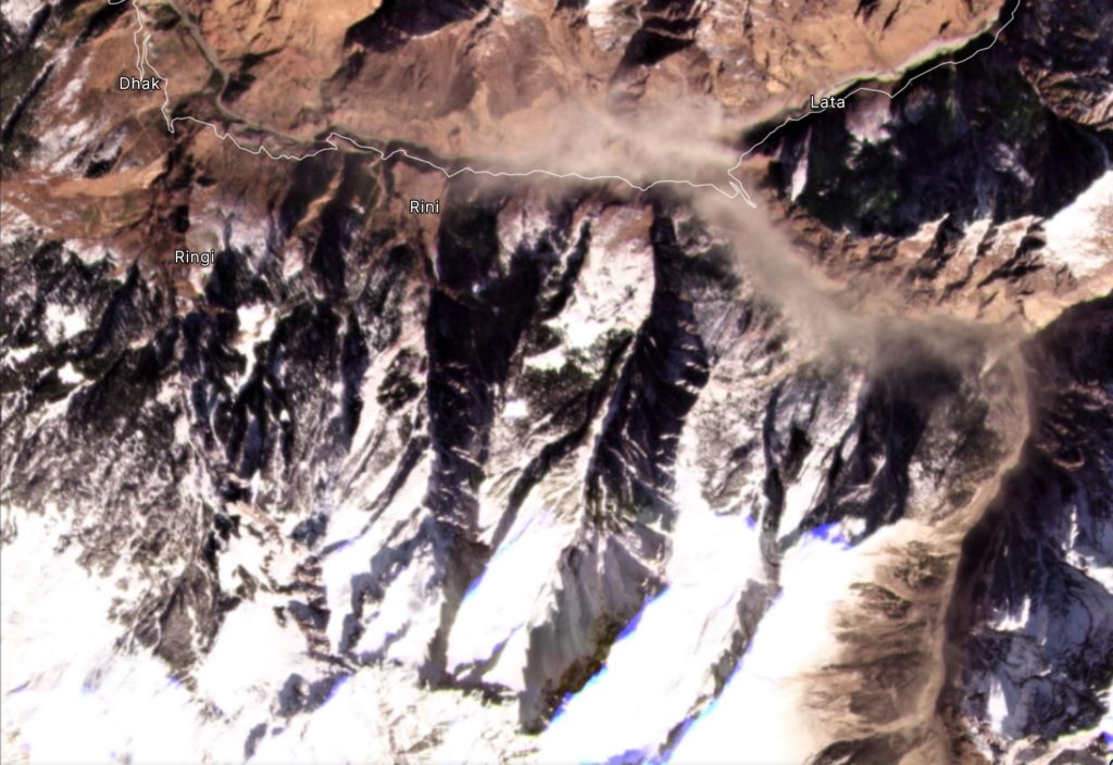
| The area of the landslide downstream from Trishuli that caused the Chamoli flood. Image copyright Planet Labs, used with permission. |
The valley with the road marked is the one containing Raini (located where steep bends are seen in the east) and Tapovan, as shown in the first image in this post.
In many ways this event is similar to the 2012 Seti River flood in Nepal. That was also triggered by a giant rockslope failure, from the Annapurna massif, which transitioned into a catastrophic flood.
Hopefully we will get further images soon of the upstream areas to understand this event (and of course to determine the risk of another event), but it is now clear that this was a landslide. In the meantime, rescue operations are underway. Reports suggest about 10 bodies have been recovered.
Reference
Planet Team (2020). Planet Application Program Interface: In Space for Life on Earth. San Francisco, CA. https://www.planet.com/

0 Response to "Chamoli: the catastrophic flood was caused by a landslide"
Post a Comment
Disclaimer Note:
The views expressed in the articles published here are solely those of the author and do not necessarily reflect the official policy, position, or perspective of Kalimpong News or KalimNews. Kalimpong News and KalimNews disclaim all liability for the published or posted articles, news, and information and assume no responsibility for the accuracy or validity of the content.
Kalimpong News is a non-profit online news platform managed by KalimNews and operated under the Kalimpong Press Club.
Comment Policy:
We encourage respectful and constructive discussions. Please ensure decency while commenting and register with your email ID to participate.
Note: only a member of this blog may post a comment.